EXPLORATION Arizona's Holbrook salt basin holds oil, gas opportunities
Edgar B. Heylmun
Consulting Geologist
Tucson
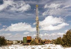
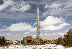
Ridgeway Arizona carbon dioxide well east of Springerville, Ariz. Photo by Steven Rauzi, Arizona Geological Survey.
Good opportunities for oil and gas production exist in the Holbrook basin of central eastern Arizona. The nearest oilfield services are at Farmington, N.M., 200 miles to the northeast. For the most part, the Holbrook basin is readily accessible from existing roads, with Interstate 40 highway running the length of the basin.
Holbrook basin
The Holbrook salt basin of eastern Arizona ranges in elevation from less than 5,000 ft to more than 8,000 ft. The basin extends eastward into New Mexico. It is located in the southern part of the Colorado Plateau province, with the Mogollon Rim marking the southern limit of the plateau ( Fig. 1 [56325 bytes]). The Arizona portion of the Holbrook basin is 160 miles long and 100 miles wide. Thousands of square miles remain untested even though numerous wells have had oil and gas shows. Some geologists believe that the basin represents a northwest extension of the Permian Basin of West Texas and New Mexico, despite the presence of intervening rifts and uplifts.Holbrook stratigraphy
Sedimentary rocks in the Holbrook basin range in age from Cambrian to Tertiary, with most interest being centered about strata of Devonian and Permian age ( Fig. 2 [23919 bytes]). All of the rocks are above 5,000 ft in depth, and the accompanying well log from the central part of the basin shows the subsurface stratigraphic section. Cambrian rocks lie on Precambrian schist and granite to the west, but in much of the basin the Cambrian is missing and Devonian strata lie directly on the Precambrian. Sedimentary units of greatest interest to drillers are as follows, from oldest to youngest:- Martin formation (Devonian). The Martin consists primarily of limestone and dolomite of marine origin, interbedded with green and red shale. A basal sandstone may or may not be present. The Martin ranges from a few feet to over 500 ft in thickness, being thickest to the west. It is not present in the eastern part of the basin. Numerous oil shows have been encountered in the Martin, and there are unconfirmed reports of free oil in some wells that penetrated the unit. The Martin is also petroliferous on outcrop where it is exposed south of the Mogollon Rim. This unit deserves to be tested wherever it is present in the subsurface.
- Redwall limestone (Mississippian). This formation, of marine origin, is present in the subsurface in the central and western parts of the Holbrook basin, but it has not been responsible for any significant oil and gas shows in wells drilled to date.
- Naco limestone (Pennsylvanian). The Naco correlates, in part, with the productive Paradox sequence in northeastern Arizona and southeastern Utah. It consists of limestone, shale, sandstone, and anhydrite of marine and tidal flat origin, ranging up to 1,000 ft or more in thickness. The unit is not present in the eastern part of the basin. The wells drilled to date have had no oil or gas shows of consequence, but in view of oil and gas production in the Paradox sequence to the north, the Naco should be tested wherever it is present in the subsurface.
- Supai formation (Permian). The Supai formation is the principal drilling objective in the Holbrook basin and has been responsible for most of the oil and gas shows encountered in wells. It consists of sandstone, siltstone, shale, limestone, dolomite, anhydrite, and salt, depending on which part of the basin one might be in. Salt occurs in the central part of the basin, where it is 500 ft or more thick, and is used for subsurface LPG storage. Anhydrite is ubiquitous throughout much of the basin and apparently was deposited, along with dolomite, in sea-margin sabkha environments similar to those seen today in the Persian Gulf region of the Middle East. Almost all wells drilled in the Holbrook basin have encountered oil and gas shows in the Supai, including small amounts of free oil in some tests. The presence of these shows would indicate that most of the rocks are thermally mature and in the oil window.
The Fort Apache member of the Supai formation, a limestone or dolomite of lagoonal origin, is found throughout the Holbrook basin, sometimes being overlain and underlain by evaporites. Oil and gas shows have been encountered in numerous wells, and it is petroliferous at surface outcrops south of the Mogollon Rim. Oil and gas shows have also been found in limestone and dolomite beds that lie above the Fort Apache. The member is 140 ft thick in the eastern part of the basin but thins gradually to the west and north to 10 ft or less.
The Supai formation as a whole ranges up to 2,000 ft or more in thickness and offers a variety of potential drilling objectives. It correlates in a general way with productive formations in the Permian Basin. At some wells in the Holbrook Basin, petroliferous Supai intervals were acidized and swabbed without success.
- Coconino sandstone (Permian). The porous Coconino sandstone overlies the Supai throughout the Holbrook basin, but for some unknown reason it has not acted as a petroleum reservoir rock. It does act as an important aquifer, and it is the principal reservoir for helium at the abandoned Pinta Dome field shown on Fig. 1. The Pinta Dome field discovery well, drilled in 1950, was allowed to blow wild for more than 2 months before it was realized that the gas was helium. When this well was brought under control, it had an initial potential of 10.8 Mcfd.
Anticlines
The Holbrook anticline, the principal fold in the Holbrook basin, trends northwest through the heart of the basin for a distance of 100 miles or more. It may be a series of en echelon folds instead of a single anticline, but it has been the target of considerable drilling that has produced oil shows and some free oil from the Supai formation. The Concho-Coyote Creek anticline parallels the Holbrook structure and also extends 100 miles or more through the heart of the basin. This feature goes by different names and has also been responsible for oil and gas shows. Many of the obvious anticlines have been drilled, but not necessarily at their structural highs, and some surface anticlines remain undrilled. It is the writer's opinion that anticlines that conform to the regional northwest trend of Laramide (Late Cretaceous) structures offer better opportunities for oil and gas production than those that trend in other directions.Volcanic field
As shown on Fig. 1, the White Mountain volcanic field conceals the southeastern part of the Holbrook basin. Much of the field consists of cinder cones and lava flows of Quaternary age. These flows form a veneer on undisturbed sedimentary strata and have had no adverse effect on possible oil and gas accumulations. A geothermal test drilled 20 miles southeast of Springerville in the volcanic field encountered the thickest section of petroliferous beds yet found in Arizona. The rocks were continuously cored, and more than 100 ft of petroliferous dolomite and limestone in the Supai formation were drilled, some of which were bleeding brown oil. The cores were cut here and there by basalt dikes that had no apparent effect on oil accumulations. Therefore, a sizable area underlying the volcanic field would appear to be oil and gas country.Carbon dioxide
Ridgeway Arizona Oil Corp., a subsidiary of Ridgeway Petroleum of Canada, has been pursuing a CO2 play near St. Johns and Springerville in the southeastern Holbrook basin the past 2-3 years. Ridgeway has drilled two successful CO2 wells, which are shut-in, and this year has been drilling several widely spaced delineation wells (see photo and adjacent story). The CO2 is found in the Fort Apache member and in other limestone and dolomite units in the Supai formation at relatively shallow depths. The discovery well, completed in 1995 in 15-12n-29e, Apache County, flowed 821 Mcfd from 1,300-1,700 ft. A second well, 4 miles south in 3-11n-29e, flowed 663 Mcfd from 1,536-1,676 ft. Gas analysis indicated 91.5% CO2, 0.65% helium, 7.7% nitrogen, and 0.2% argon. The field could have a reserve of several trillion cubic feet of CO2, so drilling continues over a broad area.Land ownership
Much of the Holbrook basin is covered by a checkerboard of state, federal, Indian, private, and railroad lands. There are large solid blocks of state, federal, and Indian lands in the southern and southeastern parts of the basin. Most of the lands on the New Mexico side of the state line are federal.Many of these lands are available for leasing if not already under lease. Unlike many states, state lands in Arizona may be leased over-the-counter, in Phoenix. The U.S. Bureau of Land Management handles leasing of national forest land.
Acknowledgment
Steve Rauzi, the Arizona state oil and gas administrator, has information on wells drilled in Arizona. He assisted in preparation of this article.Copyright 1997 Oil & Gas Journal. All Rights Reserved.

