Western Nepal Paleogene wedge may signal attractive play
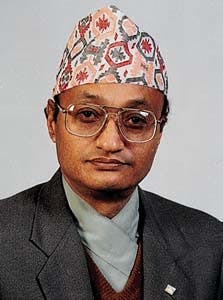
N.B. Kayastha, T.R. ShakyaRecent interpretation of seismic data acquired between 1982-92 by the PEPP/DMG Group of Nepal (Petroleum Exploration Promotion Project/Department of Mines and Geology) in the Western Nepal Foothills and Terai led to the discovery of a thick sedimentary wedge attributed to the Paleogene. The latter unconformably overlies the Vindhyan series of Late Proterozoic to Early Paleozoic age and is truncated by the Middle Miocene to Early Pleistocene Siwalik molasse.
Petroleum Exploration Promotion Project
KathmanduAlain Bruneton , Robert Gonnard
Beicip-Franlab
Rueil-Malmaison, France
The wedge appears in the Western Terai Region near the Nepal/India border. It thickens to the north with a great degree of regularity towards the Siwalik Foothills and the Lesser Himalayas of Nepal.
Geological framework
The Siwalik Foothills are relatively low hills in nature and occupy the southernmost reliefs of Nepal. They are bordered to the south by the flat, recent alluvial plains of Ganges and Terai.The Siwalik Foothills, built of parallel folds, narrow and of variable width, are comprised of 3 to 4 km thick continental lithologies (Middle Miocene to Early Pleistocene), entirely clastic in composition, from variegated shales to conglomerates. Altogether, they correspond to a destructive synorogenic molasse unit, in compensation of the rising Himalayas.
To the south, in the subsurface of the Terai Plain, these alluvium-covered series onlap old sediments of Late Proterozoic to Early Paleozoic age (Vindhyan formations) or the basement of Peninsular India, as confirmed by numerous exploration wells drilled in the Indo-Gangetic Plains of India. The southern edge of the Siwalik Range is called the "Main Frontal Thrust" (MFT). Major folds and faults are south-verging, dipping steeply northward, flattening out with depth at two main detachment levels corresponding to the base of the Siwalik Group and the base of an inferred Paleogene wedge.
The "Main Boundary Thrust" (MBT) separates the Siwalik Foothills from the Lesser Himalayas. The Lesser Himalayas are cut by major thrusts and nappes and contain sediments, metasediments, basic and acid igneous rocks of Proterozoic to Late Paleozoic age (Lakharpata and Gondwana Groups), and Paleogene age (Surkhet Group). These latter sediments largely crop out in the western Lesser Himalayas: They unconformably overlie the Lakharpata or Gondwana rocks and include the Melpani (Late Cretaceous-Paleocene), Swat (Eocene) and Suntar (Oligocene to Early Miocene) formations.
The Melpani formation consists of ferruginous quartzites and sandstones intercalated with carbonaceous dark shales and occasional limestones, and conglomerates at the base, with upward coarsening and thickening sequences. Maximum thickness reaches 280 m. A basal conglomerate usually marks the beginning of the section. The Melpani sediments were deposited as progradational units into shallow water (river-dominated delta plain and distributary channels).
The Swat formation conformably overlies the Melpani formation. It consists of dark grey shales and limestones with abundant fauna (gastropods, pelecypods, nummulites, Assilian sp.). Shales are dominant in the lower section. This formation is the equivalent of the oil producing Laki formation of the Potwar basin in Pakistan. Maximum thickness reaches 200 m. The Swat sediments represent a quiet shelf.
The Suntar formation is made of interbedded, hard, siliceous sandstones (fine to medium grained, greenish to reddish) and green, grey, purple shales with occasional beds of marls, and conglomeratic sandstones. Maximum measured thicknesses are about 750 m. The contact with the underlying formations (Swat or Melpani) is usually erosional (unconformity). A fluvial environment is postulated (river channels on a well-drained flood plain) and is reminiscent of the Lower Siwaliks.
The facies, environment of deposition and age (Oligocene to Early Miocene), correlates the Suntar formation with the Murree formation (at least the Upper Murree) of Kashmir and Potwar and the Dharmsala formation of North India. These formations (Murree and Dharmsala) pass gradually upsection to the Lower Siwaliks in India and Pakistan Foothills. The Suntar formation could be present in the Foothills and Terai of Nepal below the Lower Siwaliks.
Petroleum potential
Reservoir opportunities may exist in Proterozoic and Paleozoic rocks where highly fractured, but most of these rocks do not display significant intergranular porosity. However the Melpani sandstones of the Surkhet Group (Late Cretaceous-Paleocene) locally show fair to good porosities (7 to 10%) in the Lesser Himalayas outcrops. At some places, solid hydrocarbons occlude the effective porosity of sandstones alternating with bituminous shales.Better petrophysical characteristics may be found farther to the south, in the Foothills, below the Siwaliks, and the possibility that hydrocarbons may be reservoired in Melpani sandstones merits further investigation. Potential reservoirs exist also in the Suntar and Siwalik sandstones.
The Eocene Swat calcareous and carbonaceous dark shales of marine origin are probably the best source rocks in western Nepal. The results of many geochemical analyses done on samples of the Swat formation in the Lesser Himalayas show that numerous intervals have TOC greater than 2%. All samples are overmature, and the source rocks are of Type II organic matter (associated with a limited percentage of Type III).
Due to the high maturity of the sediments, their initial petroleum potential is unknown. The maturity of these source rocks would have much favorable conditions for hydrocarbon generation (oil or gas) in the less tectonized series of the mountain front (external Foothills) and Terai, possibly existing below the Siwaliks. The Swat shales act also as a seal for the Melpani reservoirs.
Active oil and gas seeps occur in the Lesser Himalayas of the Dailekh district northeast of Surkhet and have been known for a long time. Oil is light and severely biodegraded, and gas is thermogenic, characteristic of a gas associated with light oils or condensates. Gas and oil shows have also been recorded in the Indo-Gangetic Plains and Indian Foothills. It is worth mentioning that oil is produced from Paleogene carbonate in the Potwar basin of Pakistan and from Paleogene, Oligocene, and Miocene sandstones and limestones in the Assam basin of India.
Structure from seismic
About 500 km of seismic profiles in Terai and Siwalik Foothills of western Nepal have been recently reinterpreted ( Fig. 1 [96,044 bytes]).The main result of this work is the discovery of a well identified wedge of possible Paleogene age in the Dhangari-Nepalganj basin, west of the Faizabad ridge (Fig. 2 [135,431 bytes] ). This basin is the northern extension of the Indian Sarda basin, which comprises the Siwalik fore-deep filled up by 4,000-6,000 m of Siwaliks and up to 2,000 m of possible Paleogene unconformably onlapping a huge thickness (more than 3,000 m) of Vindhyan rocks.
Buried structures at the base of the Siwaliks and blind thrust-folds involving the Paleogene wedge have been identified at the front of the "MFT" (Fig. 3 [121,621 bytes].) These structures are undoubtedly new information which could be of great interest for petroleum exploration in Nepal as the Paleogene should include reservoirs and source rocks (Fig. 4 [54,893 bytes]).
Additional detailed seismic acquisition is necessary to delineate such structural traps.
Bibliography
Acharyya, S.K., and Ray, K.K., Hydrocarbon possibilities of concealed Mesozoic-Paleocene sediments below Himalayan nappes-reappraisal, AAPG Bull., Vol. 66, No. 1, 1982, pp. 57-70.
Agrawal, R.K., Structure and tectonics of Indo-Gangetic plains, in Geophysical case histories of India, AEG, Hyderabad, India, Vol. 1, 1977, pp. 29-46.
Alconsult International, Nepal source and seal study; Internal DMG Report, 1993.
Beicip-Franlab, Report on seismic data interpretation of Terai and Siwalik Foothills, Western Nepal, PEPP internal report, 1998.
Friedenreich, O.R., Slind, O.L., Pradhan, U.M.S., and Shrestha, R.B., 1994, Petroleum geology of Nepal, Canadian Journal of Exploration Geophysics, Vol. 30, No. 2, 1994, pp. 103-114.
Kayastha, N.B., Report on geochemical studies of field samples from Nepal: PEPP/DMG Nepal, May 1989.
Kayastha, N.B., Stratigraphy of the Lower Tertiary rocks of Nepal Himalaya, Journal of Nepal Geol. Soc., Vol. 8, 1992, pp. 21-30.
Pramanik, A.G., Ram, J., and Katiyar, G.C., Ganga basin-Geologic evolution and hydrocarbon prospectivity, Indian Journal of Pet. Geol., Vol. 5, No. 1, 1996, pp. 1-33.
Sakai, H., Stratigraphy of Tansen area in the Nepal Lesser Himalayas, Journal of Nepal Geological Society, Vol. 4, Special Issue, 1984, pp. 41-52.
The Authors
N.B. Kayastha is project chief of the Nepal Petroleum Exploration Promotion Project and has been associated with the project since its inception in 1982. He has studied geology, geophysics, and petroleum policy and management in India, Netherlands, Japan, Russia, Norway, Canada, and the U.S. He has spent 30 years with the Department of Mines and Geology. He is the author of several articles on Nepal geology.
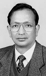
T.R. Shakya is a senior geophysicist with PEPP. Since taking higher degrees in geophysics in India and Netherlands, he has spent 18 years with full responsibilities for all the project's geophysical activities. He is involved mainly in basin analysis and modeling. He has attended several courses and seminars in India, the U.S., Canada, Norway, Singapore, Thailand, and Netherlands.
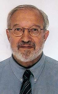
Alain Bruneton has been in charge of the geophysical department of Beicip-Franlab since 1982. He is currently involved in geophysical assistance in basin evaluation and oil and gas field studies to national or private oil companies around the world. He joined Beicip-Franlab in 1974 after graduating from the petroleum school of the French Institute of Petroleum in 1971.
Robert Gonnard is senior petroleum geologist and project manager of Beicip-Franlab. After graduating from the petroleum school of the French Institute of Petroleum in 1966, he joined this consulting firm in 1967.He has been mainly involved in petroleum evaluation of basins (geological/geophysical interpretation, modeling, prospect appraisal, exploration strategy) and multidisciplinary team management of exploration and production in Africa, Far East, South America, and C.I.S.
Copyright 1998 Oil & Gas Journal. All Rights Reserved.


