PERU OFFSHORE-1: Tumbes-Talara blocks off Peru may signal deepwater play in turbidites
Recent modeling of geological factors indicates that Peru's offshore blocks have similar characteristics and similarity in basin generation as the Angola or California-type borderland basins that place those areas among the world's top basins in terms of discovered reserves.
An exploration investment, if committed, in blocks Z5 and Z4 in the Tumbes-Talara area could signal a new play in offshore Peru. The blocks offer good indications of geological models of deepwater deposits in a turbidite environment, making viable the discovery of giant oil reservoirs.
The blocks are located off Peru's northwestern coast, with Block Z5 north of Block Z4. The border with Ecuador lies north of Block Z5. East of the blocks are Occidental Peruana Inc.-operated exploration Block Z3, Perez Companc del Peru-operated Block Z1, and Petro-Tech Peruana SA's Block Z2B.
Blocks Z5 and Z4 cover 1.2 million ha. The blocks are geologically located in the Progreso-Tumbes and Talara basins.
Exploratory drilling off Peru has evaluated all facies except the slope fan and basin floor fan environments.
The blocks offer good indications of geological models of deepwater deposits of turbidity environment that facilitates finding reservoirs with an appropriate size to support the necessary economics.
The blocks are in the Talara-Peru oil province, which has produced 1.3 billion bbl of oil. Blocks Z5 and Z4 have never been explored, and only a few 2D regional seismic lines are available.
Organic content is a basis for good sources of unaltered oils, although a different facies with more marine conditions is required. Based on these conclusions, the hydrocarbons must have migrated farther than originally suspected.
Thus, geochemical analyses give indications of farther westward extension, where more marine conditions should be present and where hydrocarbons would have been generated, mostly offshore in the westernmost part of Block Z2B or even farther west in more than 400 ft of water.
Operating costs are sharply higher in deep water, but new drilling and production technology can be applied off Peru as it has elsewhere in the world.
Exploration history
The old Peruvian State company, EPF first evaluated the onshore north front of Block Z1. It completed gravity, magnetic, and seismic surveys in 1950-68. Petroperu took over the former state company in 1968.
In 1971, the seismic contractor GSI working for Petroperu acquired and processed 1,438 line miles of 2D CDP marine digital seismic data. A year later, Petroperu signed an operating contract with Tenneco-Union-Champlin. Digicon acquired and processed a further 688 line miles of seismic for the companies.
Tenneco and partners identified 15 geologic structures and drilled the nine most attractive using a drill ship. Results were discovery of one oil field, Albacora, two wells with oil-gas shows, and the rest dry holes.
Belco Petroleum Corp. of Peru took a farmout from the consortium in 1975 and shot 375 line miles of seismic with Western Geophysical. Belco drilled 10 wells. Three confirmed Albacora field. This effort discovered 85 bcf of gas and 3.7 million bbl of crude oil. Cumulative production was 100,000 bbl of crude oil in approximately 100 days.
Belco's contract was terminated in December 1985, and the block remained inactive until 1991.
Later, American International Petroleum Corp. (AIPC), Energy Development Corp., and Hallwood Energy signed a new contract with Petroperu. The commitment was a 938-mile seismic option. The group shot 1,156 line miles of seismic with Geco-Prakla.
Apparently the group did not obtain financial support and relinquished the area. Since 1998, the original Block Z1 has been divided into blocks Z1 and Z3. Perez Companc operates Z1, and Occidental operates Z3, which covers the western part of the previous Z1 block.
Neighboring block Z2B
The Petro-Tech operated Z2B Block covers 960,000 acres, of which 20% is in the development stage and 80% is unexplored. A major portion of this unexplored area is in 400 ft of water or more.
All current production is 30-35° gravity, light crude oil with associated gas. Production averaged 24,000-26,000 b/d during 1972-85 and has declined to 13,400 b/d in 2000.
Block Z2B wells cost $1 million, relatively low for offshore operations; however, well production is low at 150,000 bbl/well estimated ultimate recovery. Production declines severely during the first 16 months of operations (40% of EUR barrels), then depletes over 7 years. Thus, most mature wells average 15 b/d.
Effective Dec. 31, 2000, the operator relinquished 200,000 ka or 50% of the block area. It retained the present producing reservoirs, which are mostly located within the transgressive fluvial delta or coastal plain-beach geological model. Deeper water means to go to the basin floor fan complex part of the model.
Most of the block is undrilled, but it has seismic coverage. A significant exploration program could be undertaken on the block's deeper water areas, which Petro-Tech retained. Some of the following could help achieve this goal and substantially change the area's makeup.
Whole basins complex
Peru's northwest coast is affected by movement of oceanic plates during Tertiary time. The South American plate overrides the Nazca plate, and the movement along the colliding plates formed the subduction zone known as the deep Peru-Chile trench and an opposite high relief Andes Mountains.
These movements, rapid erosion of the Andes, and deposition of the eroded sediments created local and large deep Tertiary basins (Fig. 1). These basins were placed west and east of the Andes Mountains.
Fig. 1 includes the physiographic and tectonic features that resulted from the interaction between oceanic and continental plates. The east-west cross-section of Northern Peru represented in Fig. 1 shows all these provinces:
- Deep Peru-Chile Trench Province.
- Andean Range Province, with intermontane basins and mountain ranges.
- Asymmetrical Subandean basin (Oriente basin) Province.
- Precambrian Shield Province (east of Fig. 1).
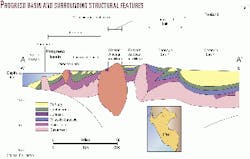
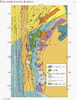
The Andean batholith is also a main element whose age ranges from Late Miocene to Late Cenozoic. Tertiary commercial production comes only from the Talara and Tumbes basins (Fig. 2).
Structural style
The Tumbes (or Tumbes-Progreso) basin lies in Peru and Ecuador north of the Talara basin. Seismic data over this basin indicate the presence of over 20,000 ft of Oligocene-Miocene and Pliocene terrigenous clastic sediments resting on Paleozoic Basement. So far, it is believed that Eocene sediments are restricted to the southernmost part of the basin.
The basin has not been drilled extensively, but oil and gas were encountered on and offshore. Structures are faulted anticlines, and others are associated with growth faulting and horsts; block faulting as in the Talara basin seems to be restricted to the south of the basin.
A prominent structural feature, the Peru Bank, lies in the western Tumbes basin in Peruvian territory. It is explained as an old basement remnant bounded by high angle faults with some 15,000 ft of displacement.
Similar Paleozoic or plutonic horsts are described in the basins. The Peru Bank and Tumbes basin (Fig. 1) were bounded by faults and filled later with Neogene sediments. These sediments thin towards the Peru Bank.
The Talara basin developed from Late Cretaceous through Cenozoic and Quaternary time. Maximum development was during Tertiary time when over 30,000 ft of sediments were rapidly deposited from a near-eastern source.
More recent seismic and drilling data indicate that the Talara basin extends southwards into the offshore from Paita and northwest of Bayovar.
In the northern part of the basin a Cretaceous section rests unconformably on Paleozoic Basement, and it is in turn overlain by Upper Eocene sediments. Southeast of Paita along the coast the Cretaceous wedges out and Upper Eocene Chira-Verdun overlies Paleozoic Basement.
Source rocks-maturation and geothermal gradient Progreso blocks Z1, Z3
Oil and gas have been produced and/or tested in various structures on land and offshore in the Tumbes basin, thus the need to understand the generation, migration, and entrapment of hydrocarbons.
In different stages Belco, AIPC, and Graña & Montero have conducted appropriate organic geochemical analyses through Robertson Research, Geochem Labs of Houston, and SVG (Russian company), respectively.
In order of importance, the Heath shales of Miocene age are the most likely source rocks, being in a moderately mature thermal stage offshore near the littoral area and becoming slightly immature on land. It is postulated that much better marine conditions will be encountered in deeper waters to the west.
The Heath shales are uniformly rich in organic content and were deposited near shore in a dominantly marine organic facies, which had the influx of terrestrial derived run-off plant detritus.
In terms of maturity, outcrop samples also indicate a moderately immature to mature thermal character and altered state becoming moderately mature offshore.
The oil windows were established at 16,500 ft (Heath formation) and 9,700 ft (bottom 700 ft of Heath formation).
Geochemical analyses are not in total agreement with above data and conclusions. The study failed to find specific sources for Tumbes basin oil. The authors concluded that the hydrocarbons have migrated farther than originally thought.
Crude oils possibly originated from multiple marine or restricted basins within or adjacent to productive reservoirs and migrated through blanket reservoirs and along faults. Also, the source facies must be richer in organic compounds than those studied in this report.
Talara basin offshore Block Z2B
Previous geochemical analyses performed by Petroperu onshore in the Talara and Lancones basins concluded that the Lower Cretaceous Muerto formation is a good source for hydrocarbon generation. Carbonates in this formation are inside the oil window and have good oil and wet gas generating potential.
Based on these conclusions, the oils must have migrated farther than originally suspected.
The La Brea-Amotape-Paita mountains being the main source of sediments for the Talara basin, more marine conditions are encountered westwards, mostly offshore in the westernmost portion of Block Z2B, or even farther west in more than 400 ft of water (Fig. 4).
It appears that Talara basin oil was derived from multiple, similar sources and reached its final characteristics by commingling during migration, accumulation, and faulting. The sources must be deeply buried with more marine kerogen than the samples analyzed.
Migration and trapping
Traps consist of a combination of structural and stratigraphical conditions, and internal Belco reports provide much information about migration and trapping.
The basin is an active feature in which sediment supply and major subsidence occurred simultaneously. Overloading of sediments into the basin caused gravitational normal faulting.
When basement is uplifted, horst and graben structures form. Unconformities also play an important role, truncating the prestructures and creating stratigraphic traps. The sedimentary units are not homogeneous and present strong lateral facies changes, creating additional stratigraphic traps (pinchouts and-or shale-outs) in between the stratigraphic units.
Reservoir rocks in the basin vary from high to very low porosity and permeability, important in the migration process. The differences create the migration paths. For this reason sedimentary studies are as critical as structural mapping.
Information on source rocks in areas of the Talara basin is very poor. The fact that the area has large oil production deterred geochemistry studies. Only in adjacent areas, like Paita-Sechura in the south and Tumbes in the north, has geochemical sampling been carried out.
It was previously mentioned which are the most favorable source rocks. However, it is postulated that the oil was generated deep in the basin depocenter, and it is also stated that the depocenter was-and is presently-located far offshore in the Pacific Ocean.
Source rocks from Cretaceous to the present day sequence are evident; they are all the shales determined in the column. All the shales have organic matter, and they can easily be the source for oil generation in the depocenter. The steep regional slope, supply of sediments, almost simultaneous faulting, and oil generation in the deepest depocenter have resulted in a unique migration and maturation setting.
Generated hydrocarbons migrate towards lower pressure; in other words, towards the east where basement outcrops. Along the migration paths some oil moves into various trap types.
After entrapment, post-migration faulting causes secondary migration in some areas. Any new uplifting causes new trapping conditions. Post-migration faulting generates abnormal oil-water contacts because some faulted blocks have been removed with their original fluid content.
In summary, finding oil in these basins strongly depends on good sedimentary, stratigraphic, structural, and fluid distribution control. It is imperative to prepare accurate maps.
Some dry gas tests in the Tumbes area suggest that the oil window has not been reached, yet the subsidence profiles of some wells show an oil window in the Heath formation. That depends on the well's location. There is not a single rule since the basin is active and the lateral variation in depth can vary greatly over short distances.
Turbidite possibilities
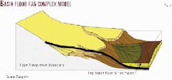
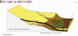
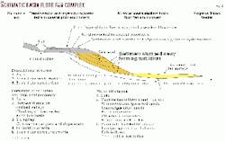
Deepwater plays are an increasing focus of international exploration and producing companies. Turbidites are not the only reservoir that occurs in deepwater frontiers, but they are the primary reservoir type of those plays (Figs. 3, 4)
The top 17 basins in terms of discovered reserves constitute those that exceed 1 billion bbl of oil equivalent ultimately recoverable.1 The top three are divergent margins (North Sea, Campos, Mars-Gulf of Mexico) and the next two are "California Type" (Los Angeles and San Joaquin) borderland basins.
Of 11 giant fields in convergent margins, nine are in "California Type" borderland basins along obliquely convergent margins.2 Without exception, the turbidite giants are located in provinces where significant reserves have been proven in other reservoir types charged from the same source rocks as the turbidites. And 34 of the 43 turbidite giants discovered by the late 1990s are productive from the Tertiary.
All geological facts indicate that the Peruvian offshore blocks have similar characteristics and similarity in basin generation as the "Californian Type." For 35 turbidite giants 25% of the traps are structural, 10% are stratigraphic, and 65% are combination. Turbidites reservoir geometry (Figs. 3, 4) is an important control on trapping, even in the case of several structurally trapped giants.
The Paleozoic arc is acting as the major trapping structural feature in the Talara basin (Fig. 2). Also, it is acting as the source of the sediments from the Paleocene to the present day.
The lithology of the area adjacent to the arc presents a series of shales and sandstones of a fluvial (meandering streams) environment. These fluvial deposits are prograding, towards the ocean, to a coastal or deltaic narrow plain. Then, always towards the ocean, distributary beach deposits, mouth bars, and offshore prodelta facies are observed. It is expected that successive sedimentary environments offshore contain a slope fan with channels and overbank turbidities and finally the massive sand turbidites typical of basin floor fans.
References
- Pettingill, H.S., "Turbidite plays' immaturity means big potential remains," OGJ, Oct. 5, 1998, p. 106.
- Pettingill, H.S., "Lessons learned from 43 turbidite giant fields," OGJ, Oct. 12, 1998, p. 93.
The author
Alberto Arispe has 35 years of experience as a petroleum geologist dedicated primarily to Latin America. General manager of Conex SAC since 1996, he is a specialist in exploration geology in the Andean countries and particularly in the Talara and Amazon basins. He has held positions with Petroleos Mexicanos, Belco Petroleum Corp., Enron Oil & Gas Co., and Petro-Tech Peruana SA. He has a BS engineering degree in geology from San Marcos University in Lima, Peru. E-mail: [email protected]
