Here are recommendations in search of giants in Pakistan
Could giant fields remain to be found in Pakistan's basins? The first part of this two-part article introduced the question (OGJ, Jan. 3, 2000, p. 56).
A few well-placed exploratory wells would help answer this question. Here are recommendations for their location.
First recommendation
Drill all very large structures, as yet undrilled or discarded after one or two mislocated dry holes, at seismically selected locations in the vicinity of proven hydrocarbon accumulations:
Upper Indus basin
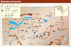
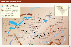
Semi-ready prospects are Nandrakki, Makhad, Jhelum River, North Domeli, and Rohtas, while the Golra Sharif, Khairi Murat, and Jogi Tilla gravity anomalies are leads8 (Fig. 6).
Central Indus basin
Semi-ready prospects are Fort Munro, Bambor, and Zin, and the Bahawalpur, Multan, and Leiah basement highs are leads9 (Fig. 7). The latter three are sub-alluvium leads obtained as a result of magnetic-gravity modeling10 of large dimensions, with depths to basement of 3.5 km, 3 km, and 2.5 km, respectively.
Since the seismic picture depicts a monocline with little relief, it is possible that these basement "highs" just reflect zones of more dense and more magnetic rocks of the basement. Information on density and magnetic contrasts in the metamorphics, however, makes this rather unlikely. Depth of penetration and direction of seismic sections thus becomes critical. Seismic surveys should be carried out along N-S sections and these basement horst blocks closely examined.
Lower Indus basin
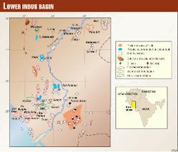
Semi-ready prospects are Pir Mangho, Hab River, Malir River, Ran Pethani, Pano Aqil, and offshore reefs11 12 (Fig. 8).
In the Indus Offshore seismic has outlined seismic anomalies that appear to be reefs at the edges of Oligocene, Paleocene, and Cretaceous carbonate platforms, with superimposed/parallel younger reefs. In view of Paleocene-Eocene source rock potential in the offshore extension of the Karachi trough, these are good prospects. Medium-sized individually, collectively they would be considered a giant prospect (Fig. 9).
Second recommendation
Drill large multiple-reservoir structures in the vicinity of structures with multiple pay zones. This would require deepening of existing wells in some cases.
Upper Indus basin
A number of producing reservoirs are present in the sedimentary section ranging in age from Cambrian to Miocene (Fig. 6).
In Toot oil field only one reservoir, Jurassic Datta, is producing. Attempts have to be made to exploit the Tertiary carbonate reservoir, with horizontal drilling deployed to locate the porous spots of the limestone reservoir. A stratigraphic wedge deeper than 3.0 sec has to be drilled to test Permian and older reservoirs. Dakhni gas-condensate field is an Eocene Chorga* pool. Untested potential reservoirs are Cretaceous and Jurassic. Seismic data show 1.5 sec of stratigraphic section below the top of Chorga* and above flat-lying seismic events at base of structure, which equates to about 3,000 m.
Central Indus basin
Hydrocarbon-bearing reservoirs include Jurassic Chiltan, Samanasuk, Cretaceous Parh limestone, Mughalkot, Pab sandstone; Ranikot/Dunghan-Sui Main, Sui Upper; Kirthar. Wells need to be deepened at Loti, Pirkoh, Uch, and Qadirpur (Fig. 7).
Lower Indus basin
Production has been mainly from Lower Goru upper sands (Fig. 8). Deep wells drilled in existing fields have found pay zones in Middle or Basal sand reservoirs. Wells drilled for upper sands have to be deviated for crestal locations of middle and basal sands.
Potential hydrocarbon plays can be envisaged in Sembar reservoirs. Distal Lower Sembar sediments were deposited in a faulted Middle Jurassic Chiltan sea bed. Middle Sembar, a prograding beach/barrier system, is characterized by a thick clinoforming wedge of fine-medium grained sand and siltstones.
After cessation of middle Sembar sedimentation, drowning occurred, and distal sedimentation continued in the west of probably transgressive sands reworked from Middle Sembar clinoforms developed against the last clinoform paleoslope. Structural highs and convergent faults with Chiltan grabens just west of the last Middle Sembar clinoform paleoslope are recommended.
Pab sandstone has become an important new reservoir member, and existing wells like Mazarani, Sari, Hundi, and Kothar should be deepened to test this reservoir.
Third recommendation
Seek and drill strat traps that may have formed along the truncation edges of Mesozoic-particularly Jurassic-Lower Cretaceous and Pab sandstone-wedges.
Upper Indus basin
Jurassic/Datta sandstone enjoys the privilege of occurrence beneath a major unconformity, a major break in time and tectonic regime, such that the Jurassic sands occur on horsts buried beneath organic marine shales (Fig. 2). Such facies make excellent reservoirs in some giant fields of the world.
This reservoir is present in the Meyal, Dhulian, Toot, Dhadamber, and Dhermund wells and absent in the Kotsarang, Karasal, Jhatla, Karang wells (Fig. 6). Strat traps can be sought along this N-NW to S-SE trend.
In producing fields like Toot, the depositional environment of individual sand packages within the overall pay zones is very interesting. Variations in crude suggest that many different oil saturation lenses exist within layers I, II, III, and IV with proven oil columns, tight to porous sandstone, continuous in some cases and lenticular in others, deposited in a delta on the edge of an arid area.
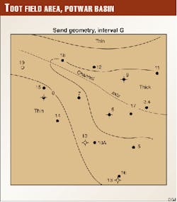
Altogether there are 13 units A-M. Layer III thickens SE instead of NW as the others. Most sands grade coarser upward in a cyclic manner. Only in Well 6 was a channel sand found in interval 'G,' a clean channel fill sand marking the axis of a stream mouth bar development, which is recommended for further evaluation (Fig. 10).
Central and Lower Indus basin
In the Jacobabad well, the Jurassic Chiltan (Sulaiman) carbonate complex is made up of shallow shelf facies, whereas in the outcrops of the Marri Bugti and Kirthar Range areas it is comprised of relatively deeper-water facies. This abrupt facies change is analogous to that of Jurassic carbonates in the Middle East, where the latter are prolific reservoirs.
A Jurassic carbonate bank may exist along the contact zone between Middle Jurassic shelf and basinal facies with associated pinnacles and patch reefs alongside. Strengthening this premise is the existence of large bioherms at the Spinghar, Dara Manda, and Gurmai outcrop sections. It is recommended to investigate this fairway incorporating seismic projected to outcrops.13
Pab sandstone (Figs. 3, 4) represents the products of a tide-modified braid delta system in the Kirthar basin and can be divided into nine main reservoir units on the basis of seismic stratigraphy. The base of Pab 5 marks an abrupt change from delta-front facies into a major channel system, unidirectional extending from east to as far as lower delta front. A major fairway of stratigraphic traps may be present where delta-front sands grade undip into delta-plain shales.
Offshore Indus Delta
Two shale-ridge trends developed beyond delta-front in Middle and Late Miocene may have produced locally restricted conditions with improved source rock quality and affected syndepositional structuring of overriding delta. Potential exists for strat traps against large clay-filled channels crossing these trends.14
Seismic data suggest that the modern Indus Canyon off the Indus river and at least three other paleocanyons fed sediments to several channel-levee systems on the adjacent upper Indus Fan (Fig. 11). Sediment thickness shows several basins separated by basement highs, with the Offshore Indus basin located on the uppermost parts of the upper Indus fan and shelf slope, having a sedimentary thickness 5.5 sec two-way time or more than 11 km, and reflecting sedimentation since Late Cretaceous and earlier times.
The fan sequences/turbidite mounds have been deposited since Late Oligocene or Early Miocene. Seismic sequence and facies analysis can be used for accurate mapping of the paleocanyons and channels, to determine lithologies, and to identify locales of sand deposits. The latter can yield giant hydrocarbon deposits provided the delta-slope shales have mature source rocks.15
Conclusion
This article certainly does not provide answers to all the questions vis-
References
- Kamen-Kaye, M., "Geology and productivity of Persian Gulf synclinorium," AAPG Bull., Vol. 54, No. 12, December 1970.
- White, R.N., "Depositional history and prospectivity of Sembar formation, OGDC archives, November 1992.
- Quest, M., "A geological and petrophysical study of cores from Adhi Wells 10 and 11," Core Laboratories, September 1990, revised May 1991, OGDC archives.
- Scientific Software Intercomp, "Reservoir study update," March 1986, OGDC archives.
- IEDS Ltd., "Middle and basal sands of Lower Goru," June 1996, OGDC archives.
- Gearheart Geoconsultants Ltd., "Review of the geology of the Lower Goru reservoir, Badin Block," May 1998, OGDC archives.
- Oolithica Geoscience Ltd., "Pab depositional sequence stratigraphic model," October 1998.
- OGDC-TSD, "Inventory of structures Potwar-Kohat-Bannu, (Upper Indus)," November 1984, OGDC archives.
- OGDC-TSD, "Inventory of structures, Sulaiman basin (Cental Indus), November 1984, OGDC archives.
- OGDC/TSD-US/NSF, "Magnetic-gravity modeling," 1978, OGDC archives.
- OGDC-TSD, "Inventory of structures, Kirthar basin (Lower Indus)," November 1984, OGDC archives.
- Quadri V.N., and Quadri, S.M.G.J., "Indus basin off Pakistan contains few wells," OGJ, June 16, 1997, p. 68.
- Quadri, V.N., and Quadri, S.M.G.J., "New Jurassic plays possible in Pakistan," OGJ, Oct. 26, 1998, p. 92.
- Alder, K.E., "Preliminary geological interpretation of the Offshore Indus Delta, Pakistan," May 1989, OGDC archives.
- Coumes, F., and Kolla, V., "Indus fan: seismic structure, channel migration and sediment thickness in the upper fan," in Haq and Milliman, eds., "The geology and oceanography of Arabian Sea and Coastal Pakistan," 1984.
