Monitoring And Education Help Seismic Crew Protect Environment In Transition-Zone Survey
A. Frank Perkins
Western Geophysical
New Orleans
Mark H. Gagliano,
Paul Moses
Coastal Environments Inc.
Baton Rouge, La.
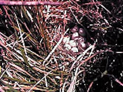
Surveyors in the Delta Wildlife Refuge discovered what is believed to be the first natural rookery for the highly endangered Mottled Duck.A program based on active monitoring and education helped Western Geophysical late last year complete a large speculative 3D seismic survey in a sensitive Louisiana transition zone without creating the need for environmental remediation.
Environmental authorities praised the program for, among other things, enabling Western Geophysical to discover a rookery of the endangered Mottled Duck and avoid disturbing it. The company has decided to use the program in all transition-zone surveys in the southeastern U.S.
Based on careful planning and equipment selection, the program helped Western solve problems common to all geophysical work in transition zones, which raise a host of environmental issues.
Seismic exploration brings people and equipment into daily contact with the earth's resources and ecosystems, including areas of extraordinary environmental value and sensitivity. Although regulations and standards vary from state to state and country to country, certain issues are universal.
Offshore, they relate to fisheries, disturbance of marine mammals and other wildlife, tourism, other vessels, archaeology, and explosives. Onshore, they involve vegetation removal, erosion, tourism, sociocultural factors, archaeology, disturbance of wildlife, and conflict with other land uses.
Transition zones, which encompass shallow water, surf, swamps, and marshlands, are among the most difficult prospects for 3D seismic surveys because of their complexity and the fact that they include elements and issues of both onshore and offshore operations.
Standard land survey techniques and equipment can be inefficient in swamps or marshes, and deepwater streamer surveying technology cannot be used to survey shallow water, congested areas, or near-shore surf zones. The seismic services industry has developed and adapted a wide range of specialized energy sources, receivers, and recording devices to solve the unique challenges presented by transition-zone regions. These include ocean-bottom cable (OBC) acquisition and processing, RF telemetry systems, 24-bit digital recording, multichannel recording systems, and air-gun, vibrator, and explosive energy sources.
Even so, private landowners, governments, regulatory agencies, and wildlife groups have adopted special requirements for activities in sensitive environments. Failure to comply with those requirements can lead to costly damage, fines, delays, extensive mitigation, and even permit revocation. As a result, seismic contractors are expanding their environmental impact focus from monitoring and correcting to education and avoidance.
To this end, Western Geophysical and Coastal Environments Inc., a Baton Rouge environmental consulting firm, developed a two-part environmental protection program for the Delta Wildlife Refuge survey that incorporated both monitoring and education (Fig. 1 [615,151 bytes]). Based on the success of that program, the two companies agreed to have all Western Geophysical crews implement the program in the southeastern U.S.
The objective of the program is to develop a systematic approach to regional environmental protection that can be implemented and monitored primarily by educated crew members and management, with outside monitors used only on an as-needed basis. The rationale is that proper tools and planning are prerequisites to both compliance and efficiency.
When crews understand the base regional environments in which they work and the way seasonal changes impact those environments, they can plan and operate more sensitively and efficiently, select tools and equipment more knowledgeably, and avoid slowdowns, damages, and fines. The program encompasses training by biologists and environmental scientists who work full-time as salaried crew members, close cooperation with regulators, compliance and monitoring, and contingency planning.
Systematic approach
The monitoring and education program implemented in the Delta Wildlife Refuge survey follows a systematic approach with an emphasis on planning as the key to impact avoidance. The approach involves several key steps:- Trafficability and sensitivity mapping. As soon as the seismic company knows it is going into an area, the first phase of the program begins with the environmental monitor-educator gathering as much information as possible about that area. Satellite imagery is used to produce color infrared images of the area, which are then employed to produce trafficability and sensitivity maps that classify different types of living habitats, water zones, physical environmental features, and limits such as developed areas (Fig. 2 [479,274 bytes]). GIS technology allows for zooming in on specific areas and obtaining more detailed information. Additionally, multiple classification layers can be applied to the base map.
The sharing of trafficability and sensitivity maps proved to be of great value in the Delta Wildlife Refuge survey, particularly for reducing airboat traverse in the marshes. These maps are now an integral part of the company's planning phase for surveys.
- Field inspection. The second phase of monitoring and education is a site visit by the survey crew with the environmental crew member as guide. Seeing the site first-hand provides greater understanding of the base environment and also allows the crew managers and surveyors to experience seasonal changes that may impact operations and equipment selections.
- Working with observers. Once the planning phase is complete, the environmental educator works with the drill pushers; party managers; assistant party managers; health, safety, and environment (HSE) directors; and company management. The goal at this stage is to minimize environmental impact by limiting excessive passes, flagging problem areas and shortcuts, and rerouting crews and equipment via existing roads and waterways.
The Delta survey
The Delta Wildlife Refuge survey was part of a large speculative 3D seismic project covering over 300 sq miles in southern Plaquemines Parish, La. The 49,280-acre refuge is centered on the active delta of the Mississippi River. Habitats include the main channel of the river and its tributaries, salt and fresh marsh areas, roseau cane, natural levees, sand bars, freshwater swamp, oil and gas fields, open shallow bays, and developed areas.Environmental monitoring was a condition for granting the survey. Western Geophysical chose to make the environmental monitoring permanent and expand it to include education.
Among features of the survey area that required special concern were land building and sinking. The eastern bank of the Mississippi River in and around the Delta Wildlife Refuge is one of a few areas in Louisiana where land is actually being built rather than eroded. The building is occurring through artificial deltas that are created by carving crevasses in the bank of the river and diverting its flow. These artificial deltas are particularly sensitive (and thus well guarded) both for their physical land bodies and for the ecosystems they are spawning.
Conversely, the west bank of the river in the same area is sinking. Consequently, water is brackish (versus fresh on the opposite bank) and the bottom is mud rather than sand. Thus, within a macroenvironment, microsystems differ on either side of the river. This information was vital for crews to know and understand as they surveyed the area.
Another feature of the survey area that could have proved problematic if crews had not been educated was flotant marshes, layers of living material atop decaying marshes. Flotant marshes may appear to be dry, but walking on them reveals a softness, and the earth beneath them is mud rather than shell or clay.
If the top (living) layer of a flotant marsh is broken, the effect can be like that of quicksand. Thus, it was very important to scout ahead for features such as this.
Surveyors and observers were trained to get out of their buggies and check the substrate of any area that looked suspicious.
Operational decisions
The environmental monitors influenced operational decisions for this project in several ways.Crews used water routes wherever possible to access, deploy, troubleshoot, and retrieve equipment. Access through canes and across marsh areas was changed when impact began to be evident. Descriptions of how to identify bird rookeries were made with digital photography.
Western Geophysical chose to use an RF telemetry multichannel recording system with explosives and air-gun energy sources.
Due to the presence of oil and gas fields, pipelines, and developed areas, gradiometer surveys were done to guide offsetting or relocating of source and receiver points. Survey design software provided choices on how and where to offset and preserve design specifications. Coordination with the monitors helped select offset locations with minimal environmental impact while preserving the geophysical attributes.
A rare discovery
During April 1998, in the course of transporting surveyors, an airboat driver noticed a large nesting area adjacent to the refuge that looked like it could belong to the highly endangered Mottled Duck.Mottled Ducks are year-round inhabitants of the Delta Wildlife Refuge, and all crew members and observers on the project had been repeatedly drilled about their appearance, habits, and tendency to nest as isolated individuals rather than gathering in rookeries. In fact, during that very morning's safety meeting, the environmentalist mentioned that Mottled Ducks were moving into the area.
Discovering a Mottled Duck nest would have been interesting, but this driver had discovered what is believed to be the first natural rookery for this species.
James Harris, a biologist for the Southeast Louisiana Refuge Complex, which includes the Delta Wildlife Refuge, said the discovery illustrated the value of a good environmental education program. Harris also praised Western Geophysical for the way it reported and reacted to the discovery.
As Harris explained, the rookery was not physically on the wildlife refuge but actually on privately owned property adjacent to the refuge, so there was no requirement to report it. Nonetheless, Western reported it to Coastal Environments, which in turn reported it to the Southeast Louisiana Refuge Complex.
The recommendation of both environmental groups was to avoid shooting near the nests. Western Geophysical agreed with the suggestion and worked closely with Coastal Environments to avoid the area and ensure that all shotpoints and receiver lines were offset at least 1,500 ft from the rookery.
"This sort of thing probably wouldn't have happened 5 years ago,"said Harris.
With the speculative 3D seismic survey complete, the Delta Wildlife Refuge will now remain closed to seismic exploration crews for 5 years. However, the environmental knowledge gained and applied from this project, and the process by which it was acquired, will continue to be applied in other environmentally sensitive 3D transition-zone surveys.
The Authors
A. Frank Perkins is HSE supervisor for Western Geophysical-Southeast U.S. operations responsible for coordination of HSE programs and environmental-compliance monitoring for field crews operating from New Orleans. Active in the seismic industry for more than 17 years, Perkins holds a BS in geography from Louisiana State University and an MA in geography from Eastern Kentucky University.
Mark H. Gagliano is director of the Restoration and Monitoring Division of Coastal Enviroments Inc., Baton Rouge, La. He has a BGS from Southeastern Louisiana University. He has 7 years of experience in the fields of biology, marine and estuarine ecology, aquaculture, shellfish culture, fisheries management, 3D seismic environmental monitoring, wetland restoration, and construction.
Paul J. Moses is asstistant director of the Restoration and Monitoring Division of Coastal Enviroments Inc. He has a BGS from Louisiana State University. He has 6 years of experience in the fields of biology, marine and estuarine ecology, 3D seismic environmental monitoring, wetland restoration, and construction.
Copyright 1999 Oil & Gas Journal. All Rights Reserved.


