More data point to potential in S. Colorado sub-basin
John MorelLexam Explorations (U.S.A.) Inc. encountered strong shows of oil in 27 of 42 shallow gold exploration wells it drilled in 1992-93 along the west flank of the Sangre de Cristo mountains in south central Colorado.
Foxpark Oil & Gas Inc.
DenverTom Watkins
Lexam Explorations (U.S.A.) Inc.
Lakewood, Colo.
This also happens to be the east flank of the Tertiary San Luis basin, an area that conventional wisdom rejected for oil exploration due to the erroneous interpretation that all of the Paleozoic and Mesozoic sections were eroded away during the Lara- mide.
The oil, from within 100 ft of surface in the 300-800 ft exploratory holes, was identified as Cretaceous, and outcrops of Mancos shale, Dakota sandstones, and Morrison shale have been located. Palynology studies confirmed the black shales as Cretaceous, and TOC measurements ranged from 1.63% up to 7.31% by weight.
Since then, Lexam has acquired 30 miles of 2D seismic and 550 gravity stations to add to its regional framework of seismic, gravity, and magnetic data. The structural style of the sub-basin, named Crestone, is not as previously reported, and neither are the sediments.
Geology unfolds
The second named author of this article, a minerals geologist for Lexam, has been intimately involved in this developing play for five years. During that time he has reviewed publications and presentations that contradict Lexam's findings, but he prefers to let the data speak for themselves.In July 1997 he led a field trip, sponsored by the Rocky Mountain Association of Geologists, to the Mesozoic outcrops on the east side of the San Luis basin. There, he let about 30 geologists pound on the rocks, review the oil shows and palynology, and otherwise convince themselves that the geologic history of the San Luis basin is being rewritten.
The San Luis basin is part of the northern Rio Grande rift (Fig. 1 [22,661 bytes]) and is structurally analogous to oil producing extensional basins in Nevada and a number of highly productive rift basins around the world. Hydrocarbon bearing Cretaceous rocks have been found in the Albuquerque and Espanola basins on the New Mexico side of the Rio Grande rift. As demonstrated by Lexam, they are also present in the San Luis basin.
The development of traps in prerift Cretaceous rocks is associated with rift-related transfer zones. Two types of structural traps, closed structures and fault blocks, have been mapped seismically. Stratigraphic traps are anticipated, but they lack control. All surrounding basins with Cretaceous source/reservoir rocks below 7,000 ft contain basin centered hydrocarbon accumulations that are productive.
Earlier views
Previous interpretations of the San Luis basin have postulated a regional uplift between the San Juan sag on the west and the Raton basin on the east that rose during the Laramide about 55 to 60 million years ago. The interpreted uplift persisted until about 35 million years ago, when Tertiary sediments and volcanics began to accumulate on the denuded Precambrian basement.During the last 30 million years tectonic drive has been provided by the extension of the northern Rio Grande rift. The San Luis basin consists of two half grabens, the western Monte Vista graben and the eastern Baca graben, separated by a central horst block. Tertiary fill was interpreted to range from 1,700 ft over the central basin "Alamosa horst" to over 15,000 ft in sub-basins on the flanks of the horst.
The rifting represents a markedly different structural style when compared to Laramide compression and uplift. What has been absent, and understandably difficult to assemble, is a clear interpretation of the tectonic interaction of Ancestral Rockies, Laramide, and finally, Rio Grande deformation. It was so much easier to interpret when all of the pre-Tertiary evidence was postulated to have been eroded away.
Latest interpretation
What has been found is an oily Mesozoic section with Jurassic through Cretaceous outcrops along the east flank of the Sangre de Cristo range and a seismic character in the Baca graben that is remarkably similar to the Pierre-Dakota-Morrison section in the Raton basin.The Baca graben lies east of the Alamosa horst and is defined by gravity and seismic. An east-west cross-section (Fig. 2 [19,676 bytes]) is based on Lexam's most recent seismic and shows the preserved Cretaceous sub-basin below the Tertiary fill. A new interpretation of the Mesozoic basin history starts after a period of erosion beveled the region prior to the deposition of the Jurassic through Cretaceous sequence.
Based on regional correlations in the Cretaceous, it is estimated that the Mesozoic package was 3,500-4,500 ft thick. The key difference in this basin history is that during the Laramide orogeny, a foreland basin formed to the east of the Alamosa horst. Fifteen to 20 million years of erosion exposed crystalline basement on the horst but left about 3,000 ft of Cretaceous sediment in the adjacent basin.
Rifting began about 30 million years ago and caused the basin to subside. At least 7,000 ft of Tertiary fill blanketed the Baca graben. During the extension and subsidence, a low angle, detachment fault boundary between the basin and the Sangre de Cristo Range left blocks of Mesozoic sediment attached to and smeared out along the fault zone. These blocks form the outcrops highlighted in the July 1997 RMAG field trip.
The low angle detachment fault (Fig. 3 [35,777 bytes]) is also a change from previously published structural styles which postulated high angle normal faults for the eastern basin boundary. The new detachment surface is seen on seismic and was penetrated by two wells Lexam drilled in 1995.
Although these wells only found remnants of Mesozoic rocks along the fault zone, they also had shows of hydrocarbons and confirmed the interpreted position of the crystalline basement. Tying the wells to Lexam's seismic data also indicates that a more complete Cretaceous section is widely preserved in the center of the sub-basin.
The Baca graben
Based on samples, shows, palynology, oil typing, outcrops, gravity, and a seismic correlation borrowed from the Raton basin 35 miles to the southeast, it appears that the Baca graben contains a preserved Mesozoic package approximately 3,000 ft thick at depths of 7,000 to 17,000 ft. This package is up to 45 miles long, 18 miles wide, and covers about 500 sq miles (Fig. 4 [31,271 bytes]). It is truly an unexplored Cretaceous sub-basin in the heart of the Rockies.The burial history of the Cretaceous section and estimated temperature gradient places these prolific source rocks within the oil/gas generation window beginning 10-15 million years ago. A regional hydrocarbon saturation is anticipated by analogy to the San Juan, Piceance, and Denver-Julesburg basins where blanket saturations are seen in several Cretaceous reservoirs. This probability is enhanced by the Crestone sub-basin's greater depth.
The future
The gold exploration program did not identify economic reserves, but Lexam has identified three Dakota oil prospects in the San Luis basin of south-central Colorado at depths ranging from 7,000 to 14,000 ft. The reserve potential of the three prospects is estimated to be 72 million bbl of oil recoverable.In addition, 10 exploration lead areas have been identified in the 40-mile-long Crestone segment of the Baca graben.
Lexam has assembled 150,000 acres of fee, state, and federal land in Saguache and Alamosa counties along the northeastern margin of the basin as part of its exploration program.
Bibliography
- Baldridge, W.S., Dickerson, P.W., Riecker, R.E., and Riolek, J., eds., Rio Grande Rift, New Mexico Geological Society, Northern New Mexico Guidebook, 1984.
- Keller, G.R., and Cather, S.M., eds., Basins of the Rio Grande Rift: Structure, Stratigraphy, and Tectonic Setting, Geological Society of America, Special Paper 291, 1994.
- An Oil Find That Was Good As Gold, AAPG Explorer, July 1995.
The Authors
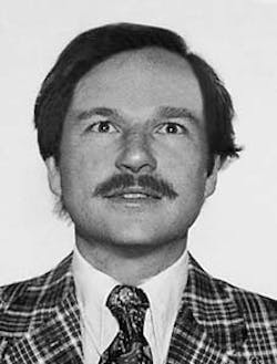
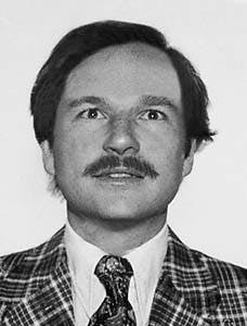
John Morel has been an oil and gas geologist and geophysicist for 22 years with Amoco, Davis Oil Co., Gary-Williams Oil Producer, Basin Exploration, and his own consulting company, Foxpark Oil & Gas. He has worked throughout the Rocky Mountain region, the Midcontinent, onshore west coast, and a few foreign concessions. Special interests include seismic stratigraphy, overpressured gas, and fractured reservoirs. Recent developments in 3D seismic have focused him on reservoir delineation studies. He holds MS and PhD degrees from the University of Wyoming.
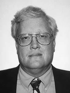
Tom Watkins has been a mineral exploration geologist for 22 years with Exxon, Coastal, Cruson and Pansze, Abermin, and Lexam Explorations, and as a consultant. He has worked extensively in Colorado as well as portions of New Mexico, Utah, Nevada, Arizona, and West Africa. He has coordinated Lexam's oil and gas exploration in the San Luis basin since the discovery of oil shows and Mesozoic sediments in 1992. The primary focus of his work is exploration for epithermal gold deposits. He holds BSc and MSc degrees from the Colorado School of Mines.
Copyright 1997 Oil & Gas Journal. All Rights Reserved.


