Gas seeps lend interest to 15,000 ft prospect in south Val Verde basin
A fifth test on the Pecos Rio Grande prospect in the nonproducing southern Val Verde basin is scheduled for November 2005 by Patterson Petroleum LP, Austin, in conjunction with Beeson Energy Inc., Aledo, Tex.
Four other wells drilled in 1992-1997 in the general area went to 3,440-12,228 ft but never penetrated the subthrust section thought to be prospective.
This 55,567-acre wildcat prospect could contain several trillion cubic feet of recoverable gas in a faulted anticline with more than 5,000 ft of vertical structural closure.
The target lies below the Ouachita Overthrust in 3,500 ft of the Pennsylvanian Strawn, Devonian carbonate, and Ordovician Ellenburger carbonate, which are responsible for the majority of gas production in West Texas.
Producing analogs include the Gomez (7 tcf of estimated ultimate recovery), Puckett (5.2 tcf), Grey Ranch (1.2 tcf), and Brown-Bassett (1.9 tcf) gas fields 40-120 miles to the northwest. However, barely any hydrocarbons have been discovered in roughly the southern half of the 2,250 sq mile basin.
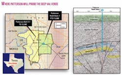
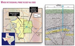
The Patterson 1 Redd State drillsite is 8 miles west of Comstock, Tex., and 8 miles northeast of the Rio Grande. It is on an upthrown block 1,000 ft from the southeast corner of Sec. 34.
Working interests in the well and green acreage are Patterson et al. 85% and Beeson 15%. Holders of the yellow acreage are Beeson 45.5%, Clyde Pursley-Paradise Oil 30%, O’Brien Energy, Shreveport, 15%, and Kyro Inc. of California 9.5% (Fig. 1).
Devil’s River country
The location is just west of the Devil’s River uplift, said Bruce Beeson, Beeson Energy.
“The prospect is related to formation of the uplift, with a large piece broken off which, due most likely to wrench faulting, is positioned at the proper interval to produce,” Beeson said. “Major oil companies acquired seismic surveys in the area, but they never shot over the prospect because their lines stopped when they got near the Pecos River. They didn’t see our prospect.”
Pursley, who has worked on this project for 15 years, was first drawn to the area by the intersection of several continental-scale lineaments trends (i.e., the Apache lineament, the Carta Valley Fault Zone, the Devil’s River lineament, and the Brown-Bassett Fault Trend).
Pursley and Beeson, with surface geology and several then-nonconventional techniques including gravity, magnetics, radiometrics, gas-sensing radar, and digital magnetotellurics-all with favorable indicators-moved ahead without new seismic.
Gas seeps
The prospect is also the site of several extraordinary degassing events that are easily seen in the Rio Grande and Pecos Rivers.
The seeps formed mud craters that were 5 ft across in 1994. Hundreds of seeps can be seen over a 36 sq mile area when the water is calm just upstream of the International Amistad Reservoir.
The seeping hydrocarbons were analyzed and found to contain low carbon dioxide counts relative to the large fields in the northern part of the basin, less than 5% on the prospect versus more than 50% CO2 in Brown-Bassett field in Crockett and Terrell counties.
Better yet, the heavy hydrocarbon content is high. This means that the hydrocarbons may be thermogenic, from great depths, and do not result from decaying mud on the river bottoms. Hydrocarbon generation appears to be from the basin deep, probably west and north of the Patterson location, said James Manatt, Providence Technologies Inc., Roswell, NM.
Most known surface seeps were drilled in the early days of exploration and resulted in discovery of several large fields. Supergiant Yates field in West Texas is one example. It was first noticed because of structural expression at the surface and seeps in the Pecos River in 1926, and it figures to produce 2 billion bbl of estimated ultimate recovery.
Geologic analysis
Manatt and Dick Boyce of Providence Technologies aided Beeson with prospect interpretation and mapping that confirmed evidence of a large structure seen in the satellite data.
Manatt said, “The seeps seem to confirm the presence of adequate source rock and system for hydrocarbon generation in the prospect area.
“We postulate that the wrench system fault(s) are both the structural trapping mechanism and the ‘plumbing system,’ enabling the established reservoir rocks of the Strawn-Devonian-Ellenburger to be charged as the gas migrates upward from the basin deep. We believe the Woodford shale is also present, so in situ sourcing is also possible.”
Beeson said, “Evidence of wrench faulting was enhanced by flower structures seen on the reprocessed data and the fit of the various river bends to known angles of a wrench fault model.” While more seismic would be helpful, Beeson and Patterson decided to spend the money on drilling instead.
Dave Koger, Koger Remote Sensing, Fort Worth, said, “It’s difficult to get your mind wrapped around a structure so large, but the truly shocking aspect is the seeps. With that much charge and heavy hydrocarbon content, the majors would have used satellite data to map them long ago if only the prospect were situated offshore. They would generate an enormous, persistent sheen on the water.”
Exploration history
The four previous drilling attempts failed to conquer the extreme challenges of drilling through the overthrust to test the underlying structure.
They are: Delta Hydrocarbons, TD 3,440 ft, 1992; Beeson Energy Zuberbuler 1, TD 3,600 ft, 1995; Beeson Energy Zuberbuler 1-ST, TD 6,448 ft, 1995; and Patterson Bell 3-1, TD 12,228 ft, 1997. The Bell ended with a crooked hole at 23° deviation, twisted off, and lost a motor in the hole. Beeson Energy reentered it in 2004 and kicked off at 8,200 ft but the hole caved in and was never deepened.
The Bell well had shows of oil and gas in the overlying Ouachita thrust, although drilling stopped short of 12,600 ft, where it would have begun to penetrate the 3,500 ft of potential pay zones.
The authority for expenditure for the upcoming well, which is to TD in the Ellenburger at 15,000 ft, is $3.5 million.

