POINT OF VIEW: Technology called key to geophysical industry's recovery
Recovery of the troubled geophysical industry will spring from the industry's core strength, predicts the incoming president of the Society of Exploration Geophysicists.
That strength, says Peter M. Duncan, founding president of MicroSeismic Inc., is technical innovation.
To escape what Duncan calls "a double whammy" now plaguing it, the industry must develop technologies that improve returns on money spent on exploration.
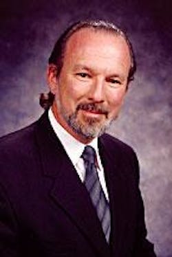
Peter Duncan
"The western companies will have to invent some technology that gives them a market edge."
A surge in seismic activity in the 1990s produced a surfeit of data without yielding enough profitably large discoveries to warrant all the expense, Duncan believes. More recently, low-cost geophysical contractors from Russia and China have snatched business from western companies.
"The western companies will have to find, discover, invent some technology that gives them a market edge and allows them to get back in the market," says Duncan, whose fledgling firm works on a technical frontier: acquiring, processing, and interpreting seismic data from natural sounds in the subsurface. He'll become president at SEG's annual meeting Oct. 26-31 in Dallas.
Exploration breakthrough
While acknowledging advances that have pushed geophysical methods beyond exploration into reservoir management and even drilling, Duncan sees exploration as the activity ripe for the kind of breakthrough the industry needs.
The industry's last boom grew out of hope that 3D methods and new imaging techniques could identify drilling targets not previously noticed in seismic data. Results have been disappointing.
"I've been involved in several different plays over the last several years where people have gone back in and reprocessed their 3D to look for the subtle trap or the subtle anomaly that was missed," Duncan says. "They've done prestack migrations, time or depth, careful amplitude work and inversions, and, yes, they've found anomalies. But the anomalies that were missed are too small to worry about nine times out of ten."
The next geophysical boom might develop from the ability to identify hydrocarbons with signatures not just difficult to notice but altogether invisible in processed seismic data.
At present, geophysicists can only infer the possibility of this type of hydrocarbon indicator, called Class 2. But two other classes of hydrocarbon indicator are well established.
In the Class 3 indicator, or bright spot, the presence of natural gas in a sandstone strengthens the sonic reflection to produce an alignment of high amplitudes on displays of seismic data.
The Class 1 indicator, called dim spot, results from a weakening of the reflection and lowering of amplitude in the hydrocarbon-bearing part of a rock layer.
So why think the absence of seismic signal in processed data might represent another type of hydrocarbon indicator?
Because, says Duncan, many large discoveries, especially in the Gulf of Mexico, have been made by luck: "drilling through them when you were going to another anomaly and finding something that had no signature on the seismic data."
According to the Class 2 theory, the boundaries of some hydrocarbon-bearing strata produce weak reflections that vary little in strength as distance—or offset—changes between sound-source locations and receivers. Data from these reflections disappear when blended in a standard processing step called stack.
The challenge is to develop mathematical tools—algorithms—able to identify the weak patterns these reflectors make in prestack data.
"The Class 2 problem is what people call the Holy Grail on the [Gulf of Mexico] shelf and something that would save us onshore," Duncan says. Solving it "would allow us to go in and find those large reserves that just don't show up as reflectors."
Pattern recognition
The pattern recognition central to solving the Class 2 problem—and to all of exploration—belongs to a broader area of geophysical research that Duncan considers important: dealing with the "plethora of patterns" generated by modern 3D surveys, computers, and workstations.
With more data, more patterns, and fewer people performing geophysical interpretation, Duncan says, "you really have a problem."
The industry is addressing the challenge with large-scale visualization—which Duncan notes has "quietly taken off—and artificial intelligence—which mathematically reduces patterns "into something the computer can recognize."
Duncan calls the use of artificial intelligence for pattern recognition "a very fertile area of research," promising interpreters the ability to "comb through large volumes of data efficiently."
Other areas of active research include increasing the number of channels in data acquisition, continuous recording, combining downhole with surface measurements, improving migration algorithms, and real-time monitoring of reservoir fluids.
They're all "meaningful developments," Duncan says, but apply mainly to field development and production.
"They're not the sort of thing that you need to go out in the deep water and find oil and gas," he says. "What you need there is pretty much just conventional work to find the big structures."
Multicomponent suspense
A technology currently in economic suspense is multicomponent acquisition, which Duncan calls "a technical joy and a business disappointment."
Multicomponent recording simultaneously records reflections of two types of sound waves: compressional (P) waves, which vibrate in the direction of sound travel, and shear (S) waves, which vibrate sideways relative to sound travel.
Interpreting S-wave data in relation to traditionally acquired P-wave data yields information about elasticity of subsurface strata, from which geophysicists can deduce rock types and fluid content.
"Everyone would agree that multicomponent data is important to completely understanding the physics of the sound that you're receiving and to being able to separate the various effects that are going on in terms of absorption and energy conversion to really work out lithologic changes from fluid changes," Duncan says.
That's important in the development of fields already discovered, especially those monitored by sequential 3D (4D) surveys. And the industry is overcoming difficulties in the processing of multicomponent data.
"But we've run into this problem," Duncan says. "The expense to get to multicomponent has never been justified by a body of casework that has shown where the multicomponent measurements made a difference between discovery and not."
Discovery, he notes, is still about finding oil and gas fields productive enough to yield competitive returns on money invested in them.
"And those big fields for the most part can be found without that subtle knowledge—with the statistics of exploration success today, at any rate."
Subsurface sound
Duncan's own company began life last January to introduce in North America a method of acquiring and processing seismic data from naturally occurring sound.
Developed by Charles Archambeau, a retired Colorado University professor, the technique has been used in South America.
In contrast with conventional seismic surveys, which measure seconds' worth of reflected energy from shocks induced near the surface or underwater, the Archambeau method measures sound originating in the subsurface, often over months or years.
In one operation, which Duncan calls transmission tomography, the sound sources are deep earthquakes. The technique measures transit time of sound waves to the surface. An interpretation step called tomographic inversion creates a structure model differentiating subsurface layers on the basis of the rates at which they propagate sound. Duncan likens the resulting 3D color cubes to images yielded by conventional inversion programs, which map velocities in depth from seismic data recorded in time.
Another operation, called emission tomography, records sound produced by subsurface creeping along faults or by changes resulting from production.
"Archambeau showed that with surface receivers you can map [fault] creep at depths of 20-30 km, creep that would be measured in movements of less than a centimeter at any given instant," Duncan says.
"By listening for a long period of time and stacking those signals, rather like a radiotelescope, you can pick out these very small signals that represent movement along the fault."
With data from this type of survey, geophysicists also can map subsurface changes caused by fluid injection or withdrawal from a producing field.
"Any type of dynamic activity in the reservoir changes the pressure field, which causes the solid earth around it to creak and groan, to crack, to fail," explains Duncan. Those displacements are measured in millimeters and can't be identified individually. Because they repeat, however, they create a signal in data recorded over time.
An onshore survey conducted this way costs as little as a tenth of the cost of a conventional 3D survey. But it takes longer: 8-12 months. Continuous processing eases the time disadvantage.
Savings come from a lower number of channels—20-40, sometimes 100 as opposed to 1,000-2,000 in conventional surveys—lower labor requirements, and elimination of the need for explosives or other sources of sonic energy.
For those reasons, and because receivers don't need to be laid out in lines, this type of survey disturbs the surface much less than do conventional land surveys. Duncan says the technique is especially useful in mountains, cities, and other areas where access is difficult.
Global community
For the association he will head, the challenge is to "create a community which is global," Duncan says. "We have to offer people around the world the same sense of community and the same services that we do to the North American group."
To that end, SEG is strengthening local sections, using the worldwide web for much of its publishing, and trying to make its lectures and short courses accessible to 80% of the membership, up from 10% typical in the past.
Characteristically, Duncan describes the challenge in geophysical terms.
"The earth is a big place," he says. "And geophysics is a big science."
Career highlights
Peter M. Duncan is founding president of MicroSeismic Inc., a Houston firm specializing in surveys using the earth's natural seismicity. The firm, based on research of retired Prof. Charles Archambeau of Colorado University, began operations in January.
Employment
Duncan began his career as an exploration geophysicist with Shell Canada Ltd. and later joined Digicon Geophysical Corp., working in Calgary and Houston.
In 1987 he helped Digicon found ExploiTech Inc., an exploration and production consultancy. He served as president after ExploiTech became a subsidiary of Landmark Graphics Corp. in 1989.
In 1992, Duncan was one of three founders of 3DX Technologies Inc., an independent oil and gas exploration company. He served as vice-president and chief geophysicist.
Education
Duncan holds a BS in physics and geology from the University of New Brunswick and master's and PhD degrees in geophysics from the University of Toronto.

